Back
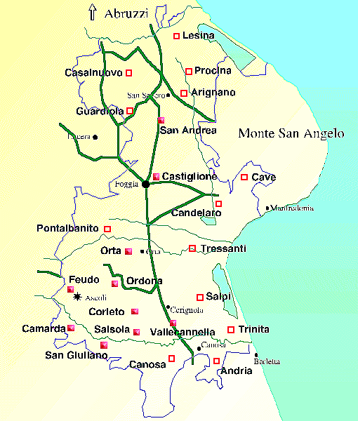
This map is adapted from a copy of an 18th century original showing the main Locationi in the Capitanata. The solid squares can be clicked to access detailed 17th century maps of each Locatione. These early maps are particularly interesting in the way they portray the contemporary landscape.
The solid pink squares give access to the old maps. The reproductions used are somewhat degraded and watermarked with 'embossed' text for copyright reasons. The originals are in the Regia Dogana collections in the Archivo di Stato, Foggia.